|
|
|
 |
| Provinces & tours |
Thai Nguyen Province |
|
|
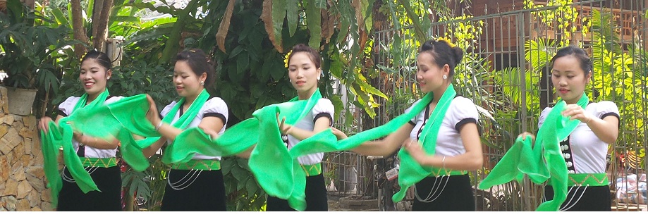
| Thai Nguyen is a province in northeastern Vietnam. It is a mountainous, midland province with natural area of 3534.45 square kilometres and a population of 1,149,100 people as of 2008.Its multiethnic society is represented by eight ethnic groups.With its rich mineral resources and salubrious climate, the province offers significant opportunities for industrial development for domestic and foreign investors. Thai Nguyen is also known as an educational centre and ranks 3rd nationwide with 21 universities and colleges. |
|
Thai Nguyen is a province in northeastern Vietnam. It is a mountainous, midland province with natural area of 3534.45 square kilometres and a population of 1,149,100 people as of 2008.Its multiethnic society is represented by eight ethnic groups.
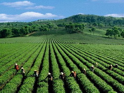
With its rich mineral resources and salubrious climate, the province offers significant opportunities for industrial development for domestic and foreign investors. Thai Nguyen is also known as an educational centre and ranks 3rd nationwide with 21 universities and colleges. The province is also the centre of tea industry in the country with an area of 16,000 ha (second only to Lam Dong) with a production of 100,000 tonnes/year; dried tea production is 25,000 tonnes/year. The tea produced here is considered the finest in Vietnam.
Climate: With terrain sloping from high mountains to the low zones and midlands, in terms temperature in winter, Thái Nguyên has three climatic sub-zones. A cold sub-zone in Vo Nhai district, a temperate subzone including Dinh Hoa, Phu Luong and southern Vo Nhai districts and a warm subzone which includes Dai Tu, Dong Hy, Phu Binh, Pho Yen districts, Thái Nguyên City and Song Cong town.
The average temperatures in the hottest and the coldest months are 28.9 °C in June and 15.2 °C in January. The lowest recorded is 13.7 °C. Total number of sunny hours in a year is ranges between 1,300 and 1,750, which is equally distributed for months in a year. The climate of Thái Nguyên has two distinct seasons: the rainy season from May to October and dry season from October to May. The average rainfall per annum lies in the range of 2,000 to 2,500 mm; it rains most in August and least in January. Generally speaking, Thái Nguyên's climate is favourable for developing agriculture and forestry.
Soil structure:
The total land area is 3,534.45 square kilometres (1,364.66 sq mi) and can be divided into three classes. Mountainous land accounts for 48.4% area and is formed from the decaying of magma, rocks and sedimentary rock. Hilly land accounts for 31.4% area and is made of condensed sand, clay and ancient alluvia. Hill land in some places such as Dai Tu, Phu Luong is 120 to 200 metres high and more with a sloping gradient of 5° to 20° and is an ideal place for planting industrial crops and perennial fruit trees. Field land accounts 12.4%, a part of which is scattered along streams and can be easily exposed to severe meteorological conditions (such as sudden floods and droughts) and is difficult to harvest. Of the total land area, 2,207.89 km² (65.22% of natural area) are used and 1,096.69 km² (30.78% of natural area) are unused. Of unused land area, only 17.14 km² area is cultivable; bare land and deserted hills occupy 412.5 km². A major problem faced by Thái Nguyên Province is to recover deserted areas.
Attractions:
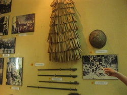
Museum of Cultures of Vietnam’s Ethnic Groups:
Museum of Cultures of Vietnam’s Ethnic Groups is located in Thai Ngyuyen City. It is the largest Montagnard museum, spread over an area of 39,000 sqm in Vietnam and was established in 1960. It is housed in a pink coloured building where an assortment of impressive exhibits of more than 10,000 documents, and artefacts which belong to the cultural heritage of 54 ethnic tribes of Vietnam can be seen.
Phuong Hoang cave:
Phuong Hoang cave is one of the largest caves in Vietnam located at a distance of 40 km from Thai Ngyuen city. The cave has four chambers where stalagmite and stalactites formations are seen. Two of the caves get lighted by sun light when the incidence direction of the rays is right. Torch light is required to see the lake interior. It served as the camp hospital and an ammunition dump for the American army during the Vietnam war. |
|
(Source:
wikipedia) |
|
|
|
|
|
|
| OTHER INFORMATION |
|
|
|
|
|
|
|
|
|
|
|
|
|
|
|
 (Copy) (2)_592019_123632.jpg)